
Thank you for supporting this site ❤️
Make a donation
Make a donation
Strawberry topographic map
Click on the map to display elevation.
Thank you for supporting this site ❤️
Make a donation
Make a donation
About this map
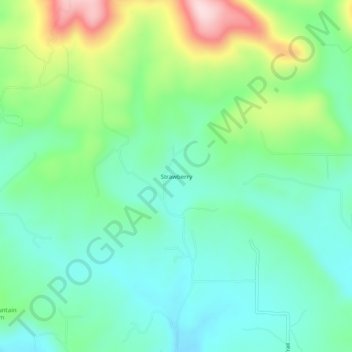
Name: Strawberry topographic map, elevation, terrain.
Location: Strawberry, Johnson County, Arkansas, United States (35.52786 -93.37435 35.56786 -93.33435)
Average elevation: 245 m
Minimum elevation: 157 m
Maximum elevation: 456 m
Thank you for supporting this site ❤️
Make a donation
Make a donation
Other topographic maps
Click on a map to view its topography, its elevation and its terrain.