
Thank you for supporting this site ❤️
Make a donation
Make a donation
Plumerville topographic map
Click on the map to display elevation.
Thank you for supporting this site ❤️
Make a donation
Make a donation
About this map
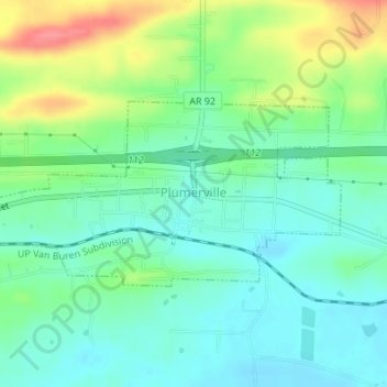
Name: Plumerville topographic map, elevation, terrain.
Location: Plumerville, Conway County, Arkansas, United States (35.15354 -92.66229 35.16686 -92.62823)
Average elevation: 106 m
Minimum elevation: 82 m
Maximum elevation: 156 m
Thank you for supporting this site ❤️
Make a donation
Make a donation
Other topographic maps
Click on a map to view its topography, its elevation and its terrain.