
Oleyres topographic map
Interactive map
Click on the map to display elevation.
About this map
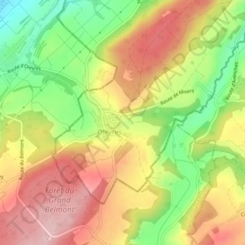
Name: Oleyres topographic map, elevation, terrain.
Location: Oleyres, Avenches, District de la Broye-Vully, Vaud, Suisse (46.84553 7.02912 46.86343 7.05842)
Average elevation: 564 m
Minimum elevation: 448 m
Maximum elevation: 664 m