
Le Fresne topographic map
Interactive map
Click on the map to display elevation.
About this map
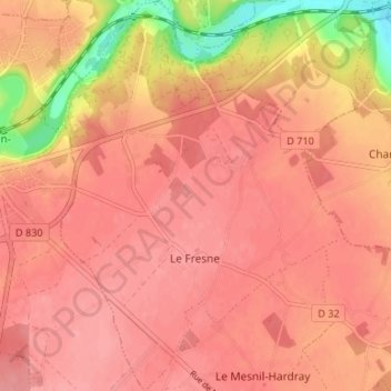
Name: Le Fresne topographic map, elevation, terrain.
Average elevation: 149 m
Minimum elevation: 86 m
Maximum elevation: 168 m
Other topographic maps
Click on a map to view its topography, its elevation and its terrain.
Orvaux
France > Normandie > Eure > Le Val-Doré
Orvaux, Le Val-Doré, Évreux, Eure, Normandie, France métropolitaine, 27190, France
Average elevation: 149 m