
Thank you for supporting this site ❤️
Make a donation
Make a donation
Adak topographic map
Click on the map to display elevation.
Thank you for supporting this site ❤️
Make a donation
Make a donation
About this map
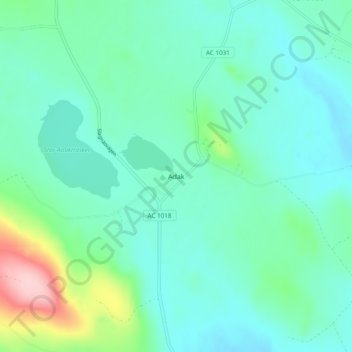
Name: Adak topographic map, elevation, terrain.
Location: Adak, Malå kommun, Västerbotten County, Sweden (65.33216 18.57775 65.37216 18.61775)
Average elevation: 410 m
Minimum elevation: 374 m
Maximum elevation: 553 m
Thank you for supporting this site ❤️
Make a donation
Make a donation
Other topographic maps
Click on a map to view its topography, its elevation and its terrain.