
Bani topographic map
Click on the map to display elevation.
About this map
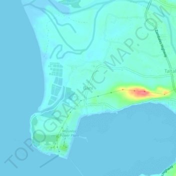
Name: Bani topographic map, elevation, terrain.
Location: Bani, Masinloc, Zambales, Central Luzon, 2211, Philippines (15.55781 119.90847 15.59781 119.94847)
Average elevation: 6 m
Minimum elevation: -1 m
Maximum elevation: 65 m