
Thank you for supporting this site ❤️
Make a donation
Make a donation
Sanvarda topographic map
Click on the map to display elevation.
Thank you for supporting this site ❤️
Make a donation
Make a donation
About this map
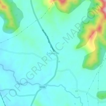
Name: Sanvarda topographic map, elevation, terrain.
Location: Sanvarda, Chiplun, Ratnagiri, Maharashtra, 415606, India (17.39420 73.51824 17.43420 73.55824)
Average elevation: 133 m
Minimum elevation: 89 m
Maximum elevation: 329 m
Thank you for supporting this site ❤️
Make a donation
Make a donation