
Thank you for supporting this site ❤️
Make a donation
Make a donation
Mainroth topographic map
Click on the map to display elevation.
Thank you for supporting this site ❤️
Make a donation
Make a donation
About this map
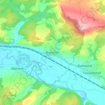
Name: Mainroth topographic map, elevation, terrain.
Average elevation: 326 m
Minimum elevation: 277 m
Maximum elevation: 429 m
Thank you for supporting this site ❤️
Make a donation
Make a donation
Other topographic maps
Click on a map to view its topography, its elevation and its terrain.
96224
Deutschland > Bayern > Landkreis Lichtenfels > Burgkunstadt > Kirchlein
Average elevation: 350 m