
Пятевщина topographic map
Interactive map
Click on the map to display elevation.
About this map
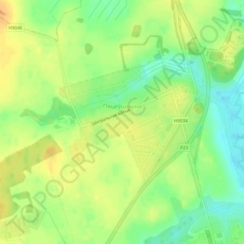
Name: Пятевщина topographic map, elevation, terrain.
Average elevation: 198 m
Minimum elevation: 180 m
Maximum elevation: 212 m
Other topographic maps
Click on a map to view its topography, its elevation and its terrain.
Самуэлево
Беларусь > Минская область > Минский район > Крупицкий сельский Совет
Самуэлево, Крупицкий сельский Совет, Минский район, Минская область, Беларусь
Average elevation: 183 m