
Thank you for supporting this site ❤️
Make a donation
Make a donation
Montargil topographic map
Click on the map to display elevation.
Thank you for supporting this site ❤️
Make a donation
Make a donation
About this map
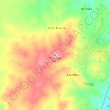
Name: Montargil topographic map, elevation, terrain.
Location: Montargil, Ponte de Sor, Portalegre, 7425-131, Portugal (39.07729 -8.18735 39.07739 -8.18725)
Average elevation: 168 m
Minimum elevation: 83 m
Maximum elevation: 237 m
Thank you for supporting this site ❤️
Make a donation
Make a donation
Other topographic maps
Click on a map to view its topography, its elevation and its terrain.