
Thank you for supporting this site ❤️
Make a donation
Make a donation
Chiriș topographic map
Click on the map to display elevation.
Thank you for supporting this site ❤️
Make a donation
Make a donation
About this map
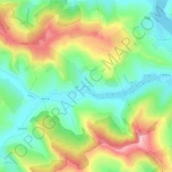
Name: Chiriș topographic map, elevation, terrain.
Location: Chiriș, Geaca, Клуж, 407301, Румыния (46.86437 24.02178 46.90437 24.06178)
Average elevation: 364 m
Minimum elevation: 283 m
Maximum elevation: 486 m
Thank you for supporting this site ❤️
Make a donation
Make a donation
Other topographic maps
Click on a map to view its topography, its elevation and its terrain.