
Huai Yai topographic map
Interactive map
Click on the map to display elevation.
About this map
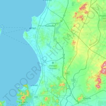
Name: Huai Yai topographic map, elevation, terrain.
Location: Huai Yai, Chon Buri Province, Thailand (12.70177 100.78939 13.02177 101.10939)
Average elevation: 54 m
Minimum elevation: 0 m
Maximum elevation: 401 m
Other topographic maps
Click on a map to view its topography, its elevation and its terrain.