
Barqueiro topographic map
Interactive map
Click on the map to display elevation.
About this map
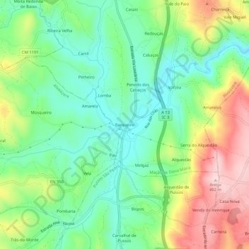
Name: Barqueiro topographic map, elevation, terrain.
Average elevation: 288 m
Minimum elevation: 189 m
Maximum elevation: 458 m
Other topographic maps
Click on a map to view its topography, its elevation and its terrain.
Tojeira
Portugal > Leiria > Maçãs de Dona Maria
Tojeira, Maçãs de Dona Maria, Alvaiázere, Leiria, 3240-465, Portugal
Average elevation: 290 m