
Thank you for supporting this site ❤️
Make a donation
Make a donation
tasnal topographic map
Click on the map to display elevation.
Thank you for supporting this site ❤️
Make a donation
Make a donation
About this map
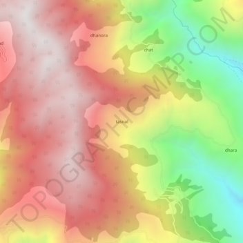
Name: tasnal topographic map, elevation, terrain.
Location: tasnal, Doda, Doda District, Jammu and Kashmir, 182201, India (33.16084 75.61231 33.20084 75.65231)
Average elevation: 2,074 m
Minimum elevation: 1,277 m
Maximum elevation: 2,628 m
Thank you for supporting this site ❤️
Make a donation
Make a donation