
Leuna topographic map
Interactive map
Click on the map to display elevation.
About this map
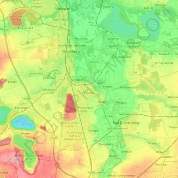
Name: Leuna topographic map, elevation, terrain.
Location: Leuna, Saalekreis, Saxony-Anhalt, 06237, Germany (51.27358 11.96998 51.37915 12.19612)
Average elevation: 103 m
Minimum elevation: 62 m
Maximum elevation: 156 m
Other topographic maps
Click on a map to view its topography, its elevation and its terrain.
Braschwitz
Germany > Saxony-Anhalt > Saalekreis > Landsberg > Plößnitz
Braschwitz, Plößnitz, Landsberg, Saalekreis, Saxony-Anhalt, 06188, Germany
Average elevation: 103 m