
Oederan topographic map
Interactive map
Click on the map to display elevation.
About this map
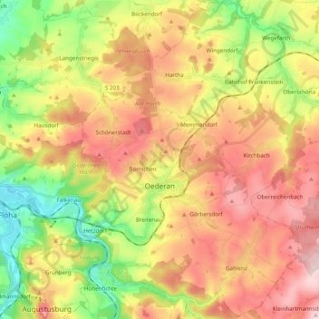
Name: Oederan topographic map, elevation, terrain.
Location: Oederan, Mittelsachsen, Sachsen, 09569, Deutschland (50.81049 13.11975 50.93210 13.25374)
Average elevation: 412 m
Minimum elevation: 269 m
Maximum elevation: 551 m