Geolocate

Province of San Marcos topographic map

Interactive map

Click on the map to display elevation.

About this map

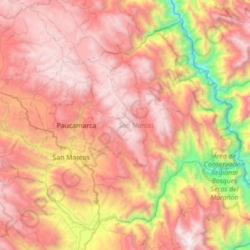
Name: Province of San Marcos topographic map, elevation, terrain.

Location: Province of San Marcos, Cajamarca, 06321, Peru (-7.48053 -78.32558 -7.06477 -77.82891)

Average elevation: 2,783 m

Minimum elevation: 920 m

Maximum elevation: 4,292 m

Other topographic maps

Click on a map to view its topography, its elevation and its terrain.

Cajamarca

Peru > Cajamarca

Cajamarca has a subtropical highland climate (Cwb, in the Köppen climate classification) which is characteristic of high elevations at tropical latitudes. This city presents a semi-dry, temperate, semi-cold climate with presence of rainfall mostly on spring and summer (from October to March) with little or no…

Average elevation: 1,456 m

Province of San Marcos

Peru > Cajamarca > José Sabogal

Average elevation: 3,865 m