
Thank you for supporting this site ❤️
Make a donation
Make a donation
Hendrieken topographic map
Click on the map to display elevation.
Thank you for supporting this site ❤️
Make a donation
Make a donation
About this map
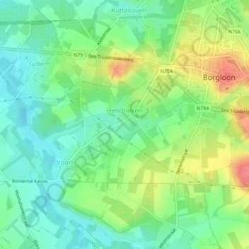
Name: Hendrieken topographic map, elevation, terrain.
Location: Hendrieken, Borgloon, Tongeren, Limburg, Vlaanderen, België (50.79094 5.31986 50.80363 5.33806)
Average elevation: 77 m
Minimum elevation: 51 m
Maximum elevation: 119 m
Thank you for supporting this site ❤️
Make a donation
Make a donation
Other topographic maps
Click on a map to view its topography, its elevation and its terrain.