
Les Herbures topographic map
Interactive map
Click on the map to display elevation.
About this map
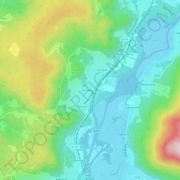
Name: Les Herbures topographic map, elevation, terrain.
Average elevation: 493 m
Minimum elevation: 370 m
Maximum elevation: 782 m
Other topographic maps
Click on a map to view its topography, its elevation and its terrain.
Le Purgatoire
France > Grand Est > Vosges > Saint-Nabord
Le Purgatoire, Saint-Nabord, Épinal, Vosges, Grand Est, France métropolitaine, 88200, France
Average elevation: 536 m
Ranfaing
France > Grand Est > Vosges > Saint-Nabord
Ranfaing, Saint-Nabord, Épinal, Vosges, Grand Est, France métropolitaine, 88200, France
Average elevation: 457 m