
Thank you for supporting this site ❤️
Make a donation
Make a donation
Ma Lâm topographic map
Click on the map to display elevation.
Thank you for supporting this site ❤️
Make a donation
Make a donation
About this map
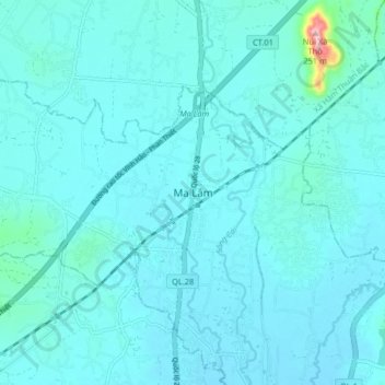
Name: Ma Lâm topographic map, elevation, terrain.
Location: Ma Lâm, Xã Hàm Thuận, Lâm Đồng Province, Vietnam (11.03507 108.09074 11.11507 108.17074)
Average elevation: 35 m
Minimum elevation: 16 m
Maximum elevation: 257 m
Thank you for supporting this site ❤️
Make a donation
Make a donation