
Perriers-la-Campagne topographic map
Interactive map
Click on the map to display elevation.
About this map
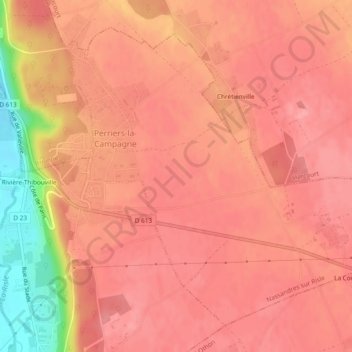
Name: Perriers-la-Campagne topographic map, elevation, terrain.
Average elevation: 133 m
Minimum elevation: 61 m
Maximum elevation: 153 m
Other topographic maps
Click on a map to view its topography, its elevation and its terrain.
Nassandres
France > Normandie > Eure > Nassandres sur Risle
Nassandres, Nassandres sur Risle, Bernay, Eure, Normandie, France métropolitaine, 27550, France
Average elevation: 115 m
Fontaine-la-Soret
France > Normandie > Eure > Nassandres sur Risle
Fontaine-la-Soret, Nassandres sur Risle, Bernay, Eure, Normandie, France métropolitaine, 27550, France
Average elevation: 115 m