
Thank you for supporting this site ❤️
Make a donation
Make a donation
Dubuque topographic map
Click on the map to display elevation.
Thank you for supporting this site ❤️
Make a donation
Make a donation
About this map
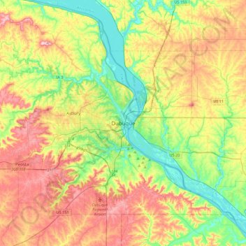
Name: Dubuque topographic map, elevation, terrain.
Location: Dubuque, Dubuque County, Iowa, 52001, United States (42.34062 -90.82480 42.66062 -90.50480)
Average elevation: 264 m
Minimum elevation: 178 m
Maximum elevation: 376 m
Thank you for supporting this site ❤️
Make a donation
Make a donation
Other topographic maps
Click on a map to view its topography, its elevation and its terrain.