
Thank you for supporting this site ❤️
Make a donation
Make a donation
Sakar Island topographic map
Click on the map to display elevation.
Thank you for supporting this site ❤️
Make a donation
Make a donation
About this map
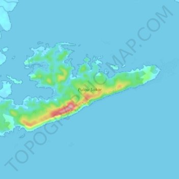
Name: Sakar Island topographic map, elevation, terrain.
Location: Sakar Island, Lahad Datu, Tawau Division, Sabah, Malaysia (4.94858 118.30355 4.99191 118.38589)
Average elevation: 8 m
Minimum elevation: -1 m
Maximum elevation: 161 m
Thank you for supporting this site ❤️
Make a donation
Make a donation
Other topographic maps
Click on a map to view its topography, its elevation and its terrain.