
Thank you for supporting this site ❤️
Make a donation
Make a donation
Calne topographic map
Click on the map to display elevation.
Thank you for supporting this site ❤️
Make a donation
Make a donation
About this map
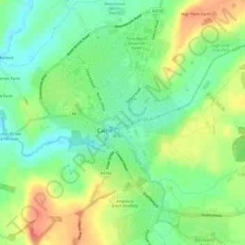
Name: Calne topographic map, elevation, terrain.
Location: Calne, Wiltshire, England, United Kingdom (51.42196 -2.01953 51.45610 -1.97494)
Average elevation: 86 m
Minimum elevation: 61 m
Maximum elevation: 121 m
Thank you for supporting this site ❤️
Make a donation
Make a donation
Other topographic maps
Click on a map to view its topography, its elevation and its terrain.