
Thank you for supporting this site ❤️
Make a donation
Make a donation
Star Valley Ranch topographic map
Click on the map to display elevation.
Thank you for supporting this site ❤️
Make a donation
Make a donation
About this map
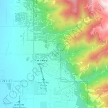
Name: Star Valley Ranch topographic map, elevation, terrain.
Location: Star Valley Ranch, Lincoln County, Wyoming, United States (42.95359 -110.98832 43.01094 -110.93853)
Average elevation: 2,093 m
Minimum elevation: 1,796 m
Maximum elevation: 2,925 m
Thank you for supporting this site ❤️
Make a donation
Make a donation
Other topographic maps
Click on a map to view its topography, its elevation and its terrain.