
Lehliu topographic map
Interactive map
Click on the map to display elevation.
About this map
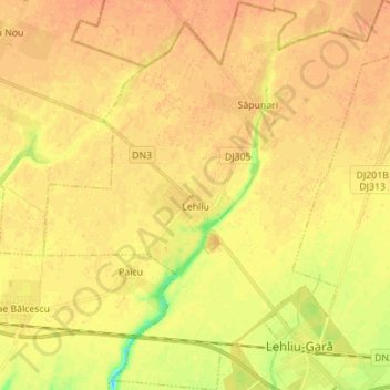
Name: Lehliu topographic map, elevation, terrain.
Location: Lehliu, Călărași, Romania (44.42860 26.76008 44.52801 26.89754)
Average elevation: 57 m
Minimum elevation: 33 m
Maximum elevation: 67 m
Other topographic maps
Click on a map to view its topography, its elevation and its terrain.
Ștefan cel Mare
Romania > Călărași > Ștefan cel Mare
Ștefan cel Mare, Călărași, 917245, Romania
Average elevation: 39 m