
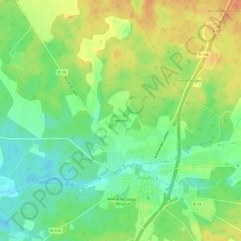
L'Arcolan topographic map
Interactive map
Click on the map to display elevation.
About this map
Name: L'Arcolan topographic map, elevation, terrain.
Average elevation: 34 m
Minimum elevation: 13 m
Maximum elevation: 58 m
Other topographic maps
Click on a map to view its topography, its elevation and its terrain.
Caloye
France > Nouvelle-Aquitaine > Landes > Magescq
Caloye, Magescq, Dax, Landes, Nouvelle-Aquitaine, France métropolitaine, 40140, France
Average elevation: 27 m