
Loomberah topographic map
Interactive map
Click on the map to display elevation.
About this map
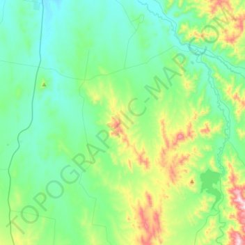
Name: Loomberah topographic map, elevation, terrain.
Location: Loomberah, Tamworth Regional Council, 新南威尔士州, 2340, 澳大利亚 (-31.41997 150.91973 -31.16230 151.10833)
Average elevation: 541 m
Minimum elevation: 395 m
Maximum elevation: 1,040 m