
Zarumilla topographic map
Interactive map
Click on the map to display elevation.
About this map
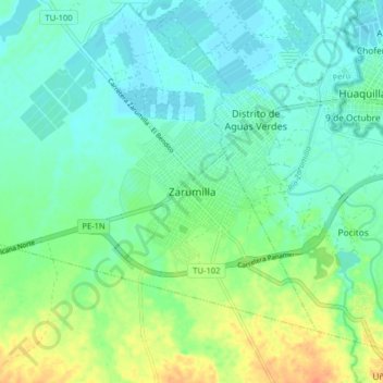
Name: Zarumilla topographic map, elevation, terrain.
Location: Zarumilla, Tumbes, Perú (-3.54057 -80.31499 -3.46057 -80.23499)
Average elevation: 12 m
Minimum elevation: 0 m
Maximum elevation: 38 m