
Thank you for supporting this site ❤️
Make a donation
Make a donation
Henderson County topographic map
Click on the map to display elevation.
Thank you for supporting this site ❤️
Make a donation
Make a donation
About this map
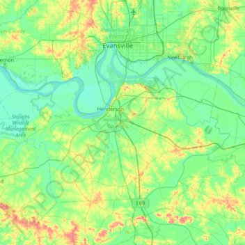
Name: Henderson County topographic map, elevation, terrain.
Location: Henderson County, Kentucky, United States (37.63834 -87.92704 37.97535 -87.27144)
Average elevation: 125 m
Minimum elevation: 104 m
Maximum elevation: 195 m
Thank you for supporting this site ❤️
Make a donation
Make a donation
Other topographic maps
Click on a map to view its topography, its elevation and its terrain.