
Thank you for supporting this site ❤️
Make a donation
Make a donation
Whitehouse topographic map
Click on the map to display elevation.
Thank you for supporting this site ❤️
Make a donation
Make a donation
About this map
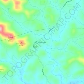
Name: Whitehouse topographic map, elevation, terrain.
Location: Whitehouse, Rutherford County, North Carolina, United States (35.50655 -82.10957 35.54655 -82.06957)
Average elevation: 378 m
Minimum elevation: 321 m
Maximum elevation: 571 m
Thank you for supporting this site ❤️
Make a donation
Make a donation
Other topographic maps
Click on a map to view its topography, its elevation and its terrain.
Thank you for supporting this site ❤️
Make a donation
Make a donation
Thank you for supporting this site ❤️
Make a donation
Make a donation