
Eindhoven topographic map
Interactive map
Click on the map to display elevation.
About this map
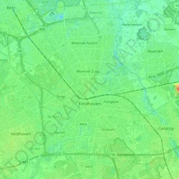
Name: Eindhoven topographic map, elevation, terrain.
Location: Eindhoven, North Brabant, Netherlands (51.40005 5.35672 51.49708 5.54885)
Average elevation: 20 m
Minimum elevation: 6 m
Maximum elevation: 54 m
Other topographic maps
Click on a map to view its topography, its elevation and its terrain.
Eindhoven
Netherlands > North Brabant > Eindhoven
Eindhoven, North Brabant, Netherlands, 5611EB, Netherlands
Average elevation: 21 m