
Kirchvers topographic map
Interactive map
Click on the map to display elevation.
About this map
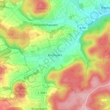
Name: Kirchvers topographic map, elevation, terrain.
Location: Kirchvers, Regierungsbezirk Gießen, Hessen, 35102, Deutschland (50.66770 8.58764 50.70770 8.62764)
Average elevation: 265 m
Minimum elevation: 188 m
Maximum elevation: 352 m