
Cereseto topographic map
Interactive map
Click on the map to display elevation.
About this map
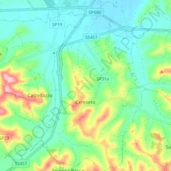
Name: Cereseto topographic map, elevation, terrain.
Location: Cereseto, Alessandria, Piemonte, Italia (45.06843 8.30253 45.11594 8.34394)
Average elevation: 183 m
Minimum elevation: 134 m
Maximum elevation: 300 m