
Sougné topographic map
Interactive map
Click on the map to display elevation.
About this map
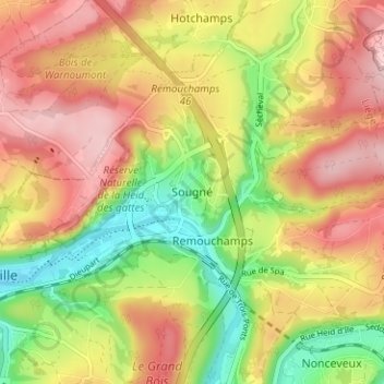
Name: Sougné topographic map, elevation, terrain.
Location: Sougné, Aywaille, Luik, Wallonië, 4920, België (50.46458 5.68922 50.50458 5.72922)
Average elevation: 224 m
Minimum elevation: 118 m
Maximum elevation: 318 m
Other topographic maps
Click on a map to view its topography, its elevation and its terrain.
Remouchamps
België > Luik > Luik > Aywaille
Remouchamps, Aywaille, Luik, Wallonië, 4920, België
Average elevation: 222 m