
Tafreg topographic map
Interactive map
Click on the map to display elevation.
About this map
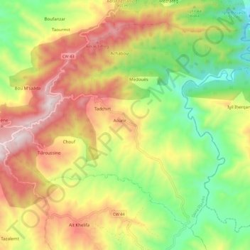
Name: Tafreg topographic map, elevation, terrain.
Location: Tafreg, Daïra Djaafra, Bordj Bou Arreridj, Algérie (36.26465 4.66870 36.33685 4.77734)
Average elevation: 833 m
Minimum elevation: 416 m
Maximum elevation: 1,317 m