
Thank you for supporting this site ❤️
Make a donation
Make a donation
Le Burnot topographic map
Click on the map to display elevation.
Thank you for supporting this site ❤️
Make a donation
Make a donation
About this map
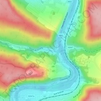
Name: Le Burnot topographic map, elevation, terrain.
Location: Le Burnot, Profondeville, Namur, Wallonie, 5160, Belgique (50.36098 4.86742 50.36121 4.86877)
Average elevation: 160 m
Minimum elevation: 78 m
Maximum elevation: 271 m
Thank you for supporting this site ❤️
Make a donation
Make a donation
Other topographic maps
Click on a map to view its topography, its elevation and its terrain.
Thank you for supporting this site ❤️
Make a donation
Make a donation
Thank you for supporting this site ❤️
Make a donation
Make a donation