
Thank you for supporting this site ❤️
Make a donation
Make a donation
Harstine Island topographic map
Click on the map to display elevation.
Thank you for supporting this site ❤️
Make a donation
Make a donation
About this map
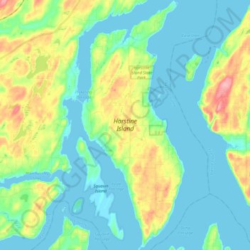
Name: Harstine Island topographic map, elevation, terrain.
Location: Harstine Island, Mason County, Washington, United States (47.16270 -122.92585 47.30175 -122.84148)
Average elevation: 30 m
Minimum elevation: -2 m
Maximum elevation: 115 m
Thank you for supporting this site ❤️
Make a donation
Make a donation