
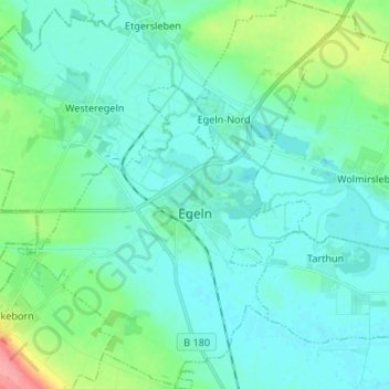
Egeln topographic map
Interactive map
Click on the map to display elevation.
About this map
Name: Egeln topographic map, elevation, terrain.
Location: Egeln, Egelner Mulde, Salzlandkreis, Saxony-Anhalt, Germany (51.90303 11.36663 51.98500 11.47769)
Average elevation: 79 m
Minimum elevation: 65 m
Maximum elevation: 145 m