
Thank you for supporting this site ❤️
Make a donation
Make a donation
Nieder-Bessingen topographic map
Click on the map to display elevation.
Thank you for supporting this site ❤️
Make a donation
Make a donation
Nieder-Bessingen
Nieder-Bessingen ist ein Stadtteil der fünf Kilometer südwestlich liegenden Kernstadt Lich im mittelhessischen Landkreis Gießen. Zum Dorf gehören die Wochenendsiedlung Albertshöhe sowie die außerhalb liegende Pein-Mühle, das Hofgut Mühlsachsen und die Wüstung Hausen. Das am Dorf vorbeifließende Gewässer ist die Wetter.
Thank you for supporting this site ❤️
Make a donation
Make a donation
About this map
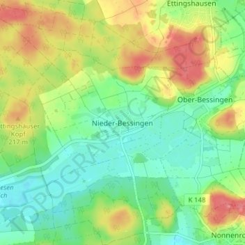
Name: Nieder-Bessingen topographic map, elevation, terrain.
Location: Nieder-Bessingen, Lich, Landkreis Gießen, Hessen, Deutschland (50.51883 8.86337 50.55883 8.90337)
Average elevation: 195 m
Minimum elevation: 167 m
Maximum elevation: 235 m
Thank you for supporting this site ❤️
Make a donation
Make a donation
Other topographic maps
Click on a map to view its topography, its elevation and its terrain.