
Thank you for supporting this site ❤️
Make a donation
Make a donation
Lemberg topographic map
Click on the map to display elevation.
Thank you for supporting this site ❤️
Make a donation
Make a donation
About this map
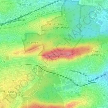
Name: Lemberg topographic map, elevation, terrain.
Location: Lemberg, Stuttgart, Baden-Württemberg, 70469, Deutschland (48.81718 9.13413 48.81728 9.13423)
Average elevation: 322 m
Minimum elevation: 284 m
Maximum elevation: 379 m
Thank you for supporting this site ❤️
Make a donation
Make a donation
Other topographic maps
Click on a map to view its topography, its elevation and its terrain.