
Thank you for supporting this site ❤️
Make a donation
Make a donation
Kolbermoor topographic map
Click on the map to display elevation.
Thank you for supporting this site ❤️
Make a donation
Make a donation
About this map
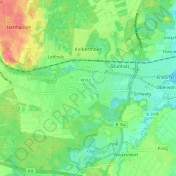
Name: Kolbermoor topographic map, elevation, terrain.
Location: Kolbermoor, Landkreis Rosenheim, Bavaria, 83059, Germany (47.81625 12.00213 47.87050 12.08417)
Average elevation: 467 m
Minimum elevation: 446 m
Maximum elevation: 504 m
Thank you for supporting this site ❤️
Make a donation
Make a donation