
Spencerville topographic map
Interactive map
Click on the map to display elevation.
About this map
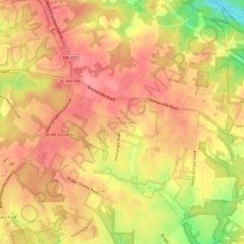
Name: Spencerville topographic map, elevation, terrain.
Average elevation: 144 m
Minimum elevation: 81 m
Maximum elevation: 173 m
Other topographic maps
Click on a map to view its topography, its elevation and its terrain.
Spencerville
United States > Maryland > Montgomery County > Spencerville
Spencerville, Montgomery County, Maryland, 20868, United States
Average elevation: 148 m