
Marina topographic map
Interactive map
Click on the map to display elevation.
About this map
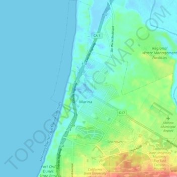
Name: Marina topographic map, elevation, terrain.
Location: Marina, Monterey County, California, 93933, United States (36.65283 -121.82075 36.72698 -121.74505)
Average elevation: 17 m
Minimum elevation: -3 m
Maximum elevation: 94 m
Marina is a city in Monterey County, California, United States. As of the 2020 census, the population was 22,359, up from 19,718 in 2010. The city is located along the central coast of California, 8 miles (13 km) west of Salinas and 8 miles (13 km) northeast of Monterey. It is on California State Route 1 between Monterey and Santa Cruz and sits at an elevation of 43 feet (13 m).