
Hammarstrand topographic map
Interactive map
Click on the map to display elevation.
About this map
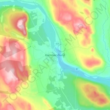
Name: Hammarstrand topographic map, elevation, terrain.
Location: Hammarstrand, Ragunda kommun, Jämtland County, 844 31, Sweden (63.06858 16.31584 63.14858 16.39584)
Average elevation: 231 m
Minimum elevation: 103 m
Maximum elevation: 444 m
Other topographic maps
Click on a map to view its topography, its elevation and its terrain.
Björnänge
Sweden > Jämtland County > Åre Björnen
Björnänge, Åre Björnen, Åre kommun, Jämtland County, 837 91, Sweden
Average elevation: 479 m
Tandsbyn
Tandsbyn, Östersunds kommun, Jämtland County, Sweden
Average elevation: 380 m
Albacken
Albacken, Bräcke kommun, Jämtland County, Sweden
Average elevation: 253 m