
Voorne-Putten topographic map
Interactive map
Click on the map to display elevation.
About this map
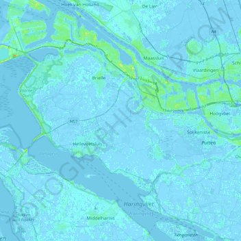
Name: Voorne-Putten topographic map, elevation, terrain.
Location: Voorne-Putten, South Holland, Netherlands (51.78518 4.02739 51.92974 4.42833)
Average elevation: 1 m
Minimum elevation: -6 m
Maximum elevation: 28 m
Other topographic maps
Click on a map to view its topography, its elevation and its terrain.
Hoeksche Waard
Hoeksche Waard, South Holland, Netherlands
Average elevation: 0 m
Kaag
Kaag, Kaag en Braassem, South Holland, Netherlands
Average elevation: -2 m
Rotterdam
Netherlands > South Holland > Rotterdam
Rotterdam, South Holland, Netherlands
Average elevation: 0 m
Noordwijk
Netherlands > South Holland > Noordwijk
Noordwijk, South Holland, Netherlands
Average elevation: 1 m