
Rwenzori Mountains topographic map
Interactive map
Click on the map to display elevation.
About this map
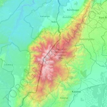
Name: Rwenzori Mountains topographic map, elevation, terrain.
Location: Rwenzori Mountains, Sindila, Bundibugyo, Western Region, Uganda (0.07049 29.74277 0.77050 30.18344)
Average elevation: 1,570 m
Minimum elevation: 685 m
Maximum elevation: 5,017 m
Other topographic maps
Click on a map to view its topography, its elevation and its terrain.
Mount Gessi
Uganda > Bundibugyo > Sindila
Mount Gessi, Sindila, Bundibugyo, Western Region, Uganda
Average elevation: 4,127 m