
Donner Lake topographic map
Interactive map
Click on the map to display elevation.
About this map
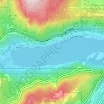
Name: Donner Lake topographic map, elevation, terrain.
Average elevation: 1,979 m
Minimum elevation: 1,808 m
Maximum elevation: 2,335 m
Other topographic maps
Click on a map to view its topography, its elevation and its terrain.
Truckee
United States > California > Nevada County > Truckee
Truckee, Nevada County, California, 96161, United States
Average elevation: 1,859 m
Prosser Creek Reservoir
United States > California > Nevada County > Truckee
Prosser Creek Reservoir, Truckee, Nevada County, California, United States
Average elevation: 1,763 m