
Sint-Katherina-Lombeek topographic map
Interactive map
Click on the map to display elevation.
About this map
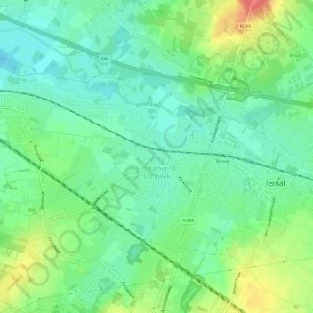
Name: Sint-Katherina-Lombeek topographic map, elevation, terrain.
Average elevation: 27 m
Minimum elevation: 5 m
Maximum elevation: 71 m
Other topographic maps
Click on a map to view its topography, its elevation and its terrain.
Wambeek
België > Vlaams-Brabant > Halle-Vilvoorde > Ternat
Wambeek, Ternat, Halle-Vilvoorde, Vlaams-Brabant, 1741, België
Average elevation: 41 m