
Green County topographic map
Interactive map
Click on the map to display elevation.
About this map
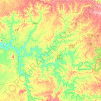
Name: Green County topographic map, elevation, terrain.
Location: Green County, Kentucky, USA (37.10935 -85.69725 37.47105 -85.35323)
Average elevation: 230 m
Minimum elevation: 148 m
Maximum elevation: 334 m
Other topographic maps
Click on a map to view its topography, its elevation and its terrain.
Georgetown
USA > Kentucky > Georgetown
Georgetown, Scott County, Kentucky, 40324, USA
Average elevation: 265 m
Mammoth Cave
USA > Kentucky > Mammoth Cave
Mammoth Cave, Edmonson County, Kentucky, USA
Average elevation: 214 m